Geodesy For Earth System Science
Our group is interested in using Earth observation data for monitoring and understanding the changes in the Earth system. Our core expertise is in processing and using geodetic datasets, such as GRACE, GNSS and altimetry, in tandem with other Earth observation datasets/models for mapping various surface processes that are related to climate change and human activities.
-
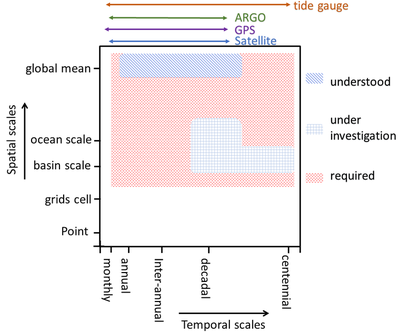
Sea Level Rise And Its Components. The observed sea-level rise can be approximately explained by a sum of steric sea height changes, mass change, and solid Earth deformations, but only for trend signal and at global average scales. We are aiming at closing the sea level budget at smaller spatiotemporal scales.
-
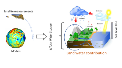
The Water Budget. Being able to map the flow of water from the atmosphere to oceans through land is essential for planning and management of freshwater. We are yet to comprehensively close the water budget and understand how it will evolve in a changing climate.
-
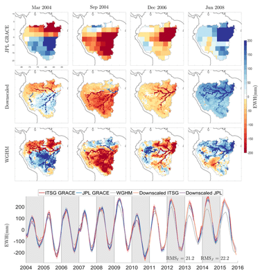
Downscaling GRACE. GRACE satellite mission has provided novel information about the water mass redistribution near the Earth’s surface, but only at large spatial scales. To use this novel mission for local hydrological applications, GRACE data must be downscaled with the help of prior information. We are working to produce a high-quality high-resolution GRACE product for India.